
The National Oceanic and Atmospheric Administration (NOAA) has an Emergency Response Division concerned with the release of oil or chemicals into the environment, such as after an oil spill or natural disaster. An early step in the response is a shoreline assessment to determine facts about the contamination and to “support decision making for shoreline cleanup.”
As a visual guide to such assessment, NOAA developed its Shoreline Assessment Job Aid (PDF). Most of the job aid consists of photos illustrating such things as:
- Amount of coverage by surface oil
- Thickness of surface oil
- Type of surface oil
- Type of subsurface oil
- Types of sediment
- Types of shoreline
Here’s an example: photos showing amounts of coverage by surface oil.

There’s also material related to beach profile (e.g., elements of a gravel beach versus a sand beach) and to more than a dozen different clean-up methods.
Since it’s made up mostly of examples and descriptions, I consider this a reference job aid.
What’s the accomplishment?
The purpose of the job aid is to have assessment team members produce consistent, accurate descriptions about the amount of contamination in a shoreline habitat.
As the job aid says, cleanup methods depend on field data about the type and degree of contamination.
Who’s the performer?
The assessment team can include the federal on-scene coordinator, NOAA scientific support staff, state on-scene coordinators, federal and state resource managers, representatives of the responsible party, landowners, and others.
Comments
Members of an assessment team need to be in reasonable agreement as they carry out their assessment. To aid that, the job aid includes guidance to help people estimate the relative percentage of coverage. I’ve combined two charts into one for this illustration; the square examples in the upper portion are for “oil band situations.” The circular examples below are for “discrete oil deposits such as tarballs.”
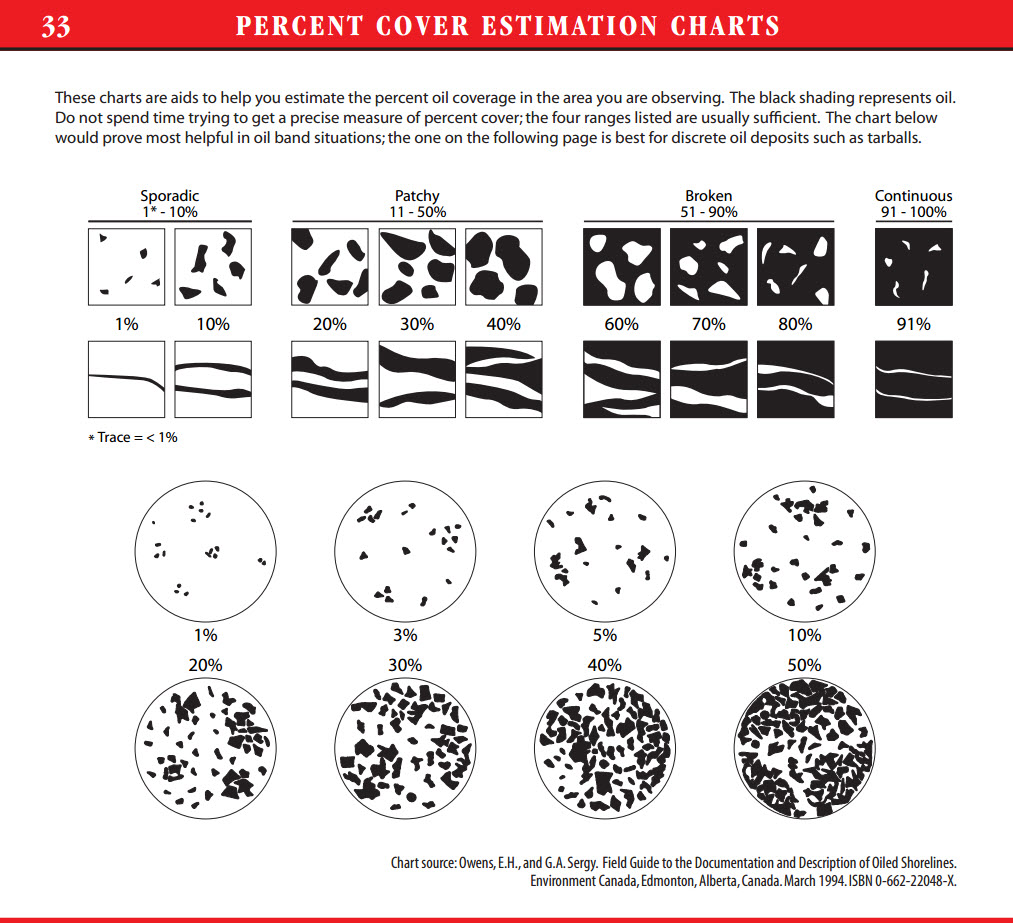
Notice also the practical advice, just above the examples:
Do not spend time trying to get a precise measure of percent cover; the four ranges listed [sporadic, patchy, broken, continuous] are usually sufficient.
The back cover of the job aid includes a 15-centimeter ruler:
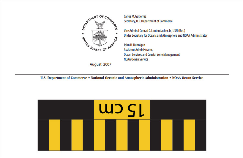 A similar ruler appears in several examples in the job aid:
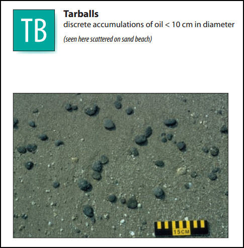
 Further information
Along with the job aid, NOAA has a Shoreline Assessment Manual that outlines the SCAT system (Shoreline Cleanup and Assessment Technique). That includes a description of team members, roles, and responsibilities; the SCAT method and process; and information about cleanup decisions based on the findings of the assessment.